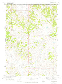
1971 Map of Corral Creek
USGS Topo · Published 1974About this map
Sand Bar West Oil Field dominates the central portion of this 1970s topographic survey, illustrating the industrial footprint of energy development in Campbell County. Numerous Well and Drill Hole markers are scattered across the landscape, connected by a network of unimproved roads and a Jeep Trail. This energy-driven landscape is defined by its complex drainage network, where Buffalo Creek and South Fork Three Bar Creek cut through the northern sections, while Corral Creek and Olmstead Creek drain the central and eastern portions. To the south, the terrain falls away toward Bitter Creek and the confluence of Armstrong Prong and Chalk Prong Armstrong Prong. The map provides a clear picture of the Wyoming high plains as the region transitioned into a more intensive period of natural resource extraction, marked by the density of petroleum-related infrastructure amidst the traditional open range.
Find a feature on this map
14 named features on this map. Tap any name to fly to it.
Don’t see what you’re looking for? This feature index may not catch every label — zoom into the map to look around manually.
Map Details
Editions of this 1971 Corral Creek Map
This is the sole edition of this map. No revisions or reprints were ever made.
Other maps of this area

1954 · Ekalaka
USGS Topo · 1:250,000

1954 · Gillette
USGS Topo · 1:250,000

1955 · Gillette
USGS Topo · 1:250,000

1956 · Ekalaka
USGS Topo · 1:250,000

1958 · Gillette
USGS Topo · 1:250,000

1958 · Ekalaka
USGS Topo · 1:250,000

1962 · Gillette
USGS Topo · 1:250,000

1965 · Ekalaka
USGS Topo · 1:250,000

1970 · Moorhead
USGS Topo · 1:24,000
1970 · Bay Horse
USGS Topo · 1:24,000