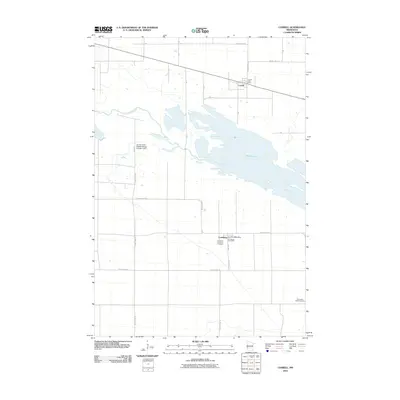
2010 Map of Correll
USGS Topo · Published 2010About this map
Marsh Lake and the Minnesota River dominate this portion of Big Stone County, defining the hydrology of the western prairie landscape. The area is anchored by the small settlements of Correll and Louisburg, both of which maintained essential community hubs including the Correll Post Office and Louisburg Post Office at the time of this survey. The infrastructure of the region is shaped by the Lac Qui Parle Wildlife Refuge Number 2 Dam, which regulates the expansive waters of the river valley.
Find a feature on this map
27 named features on this map. Tap any name to fly to it.
Don’t see what you’re looking for? This feature index may not catch every label — zoom into the map to look around manually.
Map Details
Editions of this 2010 Correll Map
This is the sole edition of this map. No revisions or reprints were ever made.
Other maps of this area

1953 · Ortonville
USGS Topo · 1:62,500

1953 · Bellingham
USGS Topo · 1:62,500

1953 · Milbank
USGS Topo · 1:250,000

1958 · Milbank
USGS Topo · 1:250,000

1958 · Cerro Gordo
USGS Topo · 1:24,000

1958 · Madison
USGS Topo · 1:24,000

1958 · Correll
USGS Topo · 1:24,000

1958 · Appleton
USGS Topo · 1:24,000

1968 · Lake Oliver
USGS Topo · 1:24,000

1968 · Artichoke Lake
USGS Topo · 1:24,000