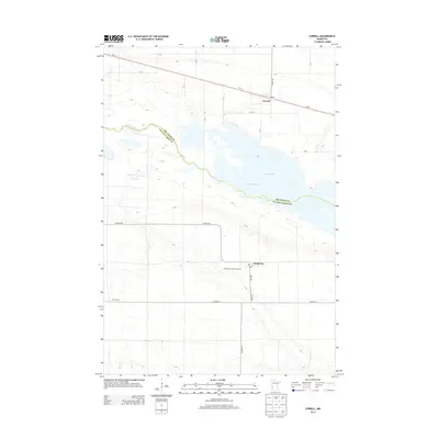
2013 Map of Correll
USGS Topo · Published 2013About this map
Marsh Lake and the winding course of the Minnesota River define the central landscape of this western Minnesota region, marking the boundary between Big Stone Co and Lac Qui Parle Co. In the northern portion of the map, the small settlement of Correll is positioned along MN-7, while Louisburg sits further south near the intersection of several county highways. The area is characterized by a strict grid of rural township roads, such as 470th St and 3rd Ave, reflecting the systematic agricultural development of the prairie. Local history is anchored by landmarks like the Louisburg Lutheran Cem and the presence of a Po in both primary towns, suggesting their roles as persistent community hubs in a primarily pastoral landscape.
Find a feature on this map
25 named features on this map. Tap any name to fly to it.
Don’t see what you’re looking for? This feature index may not catch every label — zoom into the map to look around manually.
Map Details
Editions of this 2013 Correll Map
This is the sole edition of this map. No revisions or reprints were ever made.
Other maps of this area

1953 · Ortonville
USGS Topo · 1:62,500

1953 · Bellingham
USGS Topo · 1:62,500

1953 · Milbank
USGS Topo · 1:250,000

1958 · Milbank
USGS Topo · 1:250,000

1958 · Cerro Gordo
USGS Topo · 1:24,000

1958 · Madison
USGS Topo · 1:24,000

1958 · Correll
USGS Topo · 1:24,000

1958 · Appleton
USGS Topo · 1:24,000

1968 · Lake Oliver
USGS Topo · 1:24,000

1968 · Artichoke Lake
USGS Topo · 1:24,000