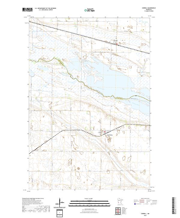
2022 Map of Correll
USGS Topo · Published 2022About this map
The Minnesota River carves a wide valley through this region of Big Stone and Lac qui Parle counties, defining the boundary between several townships. To the north, the small settlement of Correll is situated on a plateau overlooking the river's wetland margins, while Louisburg lies to the south, centered near the Post Office and the Louisburg Lutheran Cem. The landscape reflects a traditional Midwestern section-line grid, with roads like 455th St and Co Rd 36 framing vast agricultural tracts and seasonal wetlands. The Minnesota River Trl follows the southern bank of the waterway, highlighting the significance of the river corridor as both a natural boundary and a recreational axis in this part of western Minnesota.
Find a feature on this map
17 named features on this map. Tap any name to fly to it.
Don’t see what you’re looking for? This feature index may not catch every label — zoom into the map to look around manually.
Map Details
Editions of this 2022 Correll Map
This is the sole edition of this map. No revisions or reprints were ever made.
Other maps of this area

1953 · Ortonville
USGS Topo · 1:62,500

1953 · Bellingham
USGS Topo · 1:62,500

1953 · Milbank
USGS Topo · 1:250,000

1958 · Milbank
USGS Topo · 1:250,000

1958 · Cerro Gordo
USGS Topo · 1:24,000

1958 · Madison
USGS Topo · 1:24,000

1958 · Correll
USGS Topo · 1:24,000

1958 · Appleton
USGS Topo · 1:24,000

1968 · Lake Oliver
USGS Topo · 1:24,000

1968 · Artichoke Lake
USGS Topo · 1:24,000