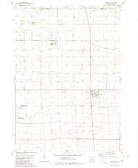
1980 Map of Corsica
USGS Topo · Published 1981About this map
Corsica serves as the central hub of this South Dakota landscape, showing a structured town grid complete with Community Park and Graceland Cem. The surrounding plains of Holland and Walnut Grove townships are defined by a mix of agriculture and conservation, most notably marked by several segments of the National Waterfowl Production Area. This system of protected wetlands suggests the region's importance as a migratory corridor, integrated into an environment managed by civil engineering features like the Garden Valley Ditch.
Find a feature on this map
21 named features on this map. Tap any name to fly to it.
Don’t see what you’re looking for? This feature index may not catch every label — zoom into the map to look around manually.
Map Details
Editions of this 1980 Corsica Map
This is the sole edition of this map. No revisions or reprints were ever made.
Other maps of this area

1899 · Mitchell
USGS Topo · 1:125,000

1955 · Mitchell
USGS Topo · 1:250,000

1959 · Mitchell
USGS Topo · 1:250,000

1979 · Geddes SE
USGS Topo · 1:24,000

1979 · New Holland
USGS Topo · 1:24,000
1979 · Armour
USGS Topo · 1:24,000

1979 · Aurora Center
USGS Topo · 1:24,000
1979 · Armour SW
USGS Topo · 1:24,000

1980 · Stickney
USGS Topo · 1:24,000

1980 · Corsica Lake
USGS Topo · 1:24,000