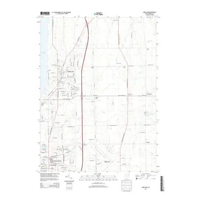
2013 Map of Cortland
USGS Topo · Published 2013About this map
Cortland and the suburban expanses of Howland Center define this Trumbull County landscape, where residential development meets the agricultural reaches of eastern Ohio. Significant aviation infrastructure is central to the area, including the sprawling Youngstown-Warren Regional Airport and the smaller Allen Airport further north. The map documents a dense network of family and community history through its numerous burial grounds, such as Hillside Cem, Sheldon Cem, and Rand Cem. Waterways like Walnut Cr and Sugar Cr drain the terrain toward the eastern edge of Mosquito Creek Lake, while small settlements like Tyrrell and Nutwood preserve the character of rural intersections. The transition from the structured street grids of Venice Heights to the open land of Fowler Ridge illustrates the continuing evolution of the region's land use in the early 21st century.
Find a feature on this map
137 named features on this map. Tap any name to fly to it.
Don’t see what you’re looking for? This feature index may not catch every label — zoom into the map to look around manually.
Map Details
Editions of this 2013 Cortland Map
This is the sole edition of this map. No revisions or reprints were ever made.
Other maps of this area

1905 · Bristolville
USGS Topo · 1:62,500

1906 · Youngstown
USGS Topo · 1:62,500

1907 · Kinsman
USGS Topo · 1:62,500

1907 · Bristolville
USGS Topo · 1:62,500

1908 · Youngstown
USGS Topo · 1:62,500

1908 · Warren
USGS Topo · 1:62,500

1950 · Cleveland
USGS Topo · 1:250,000

1954 · Sharon West
USGS Topo · 1:24,000

1954 · Girard
USGS Topo · 1:24,000

1956 · Cleveland
USGS Topo · 1:250,000