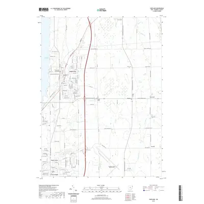
2019 Map of Cortland
USGS Topo · Published 2019About this map
Cortland serves as the primary hub of this Trumbull County landscape, characterized by its residential grid and proximity to the eastern shore of Mosquito Creek Lake. The area reflects a mix of suburban development and rural heritage, with numerous family and community burial grounds such as Hillside Cem, Casterline Cem, and Sheldon Cem scattered across the township. The Trumbull County Courthouse Central District marks the civic heart of the town, while the surrounding terrain is defined by drainage systems like Walnut Cr and Confusion Run. To the east, the rural settlements of Fowler and Nutwood sit along Youngstown Kingsville Rd, maintaining a distinct character from the more densely settled corridors near the reservoir. The southern portion of the map is dominated by the expansive grounds of the Youngstown-Warren Regional Airport, contrasting with the small crossroads communities of King Corners and Venice Heights.
Find a feature on this map
107 named features on this map. Tap any name to fly to it.
Don’t see what you’re looking for? This feature index may not catch every label — zoom into the map to look around manually.
Map Details
Editions of this 2019 Cortland Map
This is the sole edition of this map. No revisions or reprints were ever made.
Other maps of this area

1905 · Bristolville
USGS Topo · 1:62,500

1906 · Youngstown
USGS Topo · 1:62,500

1907 · Kinsman
USGS Topo · 1:62,500

1907 · Bristolville
USGS Topo · 1:62,500

1908 · Youngstown
USGS Topo · 1:62,500

1908 · Warren
USGS Topo · 1:62,500

1950 · Cleveland
USGS Topo · 1:250,000

1954 · Sharon West
USGS Topo · 1:24,000

1954 · Girard
USGS Topo · 1:24,000

1956 · Cleveland
USGS Topo · 1:250,000