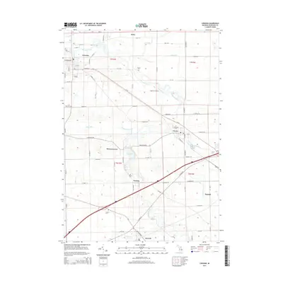
2014 Map of Corunna
USGS Topo · Published 2014About this map
The Shiawassee River meanders northwestward through this portion of Shiawassee County, connecting a string of historic settlements including Corunna, Vernon, and Bancroft. The landscape is defined by its complex drainage network, where features like Maple Swamp Drain and Hathon Drain support the surrounding agricultural lands. Notable for genealogists, the map identifies numerous local burial grounds such as Pine Tree Cem, Saint Marys Cem, and Hawkins Cem, alongside the small unincorporated community of Shiawasseetown. Transport and aviation are represented by the Corunna Station and the Millstream Airpark near the river. The concentration of named drains and small water bodies like Shiawassee Pond reflects the area's history of water management to sustain the town centers and farmsteads that grew along the river valley during Michigan's development.
Find a feature on this map
56 named features on this map. Tap any name to fly to it.
Don’t see what you’re looking for? This feature index may not catch every label — zoom into the map to look around manually.
Map Details
Editions of this 2014 Corunna Map
This is the sole edition of this map. No revisions or reprints were ever made.
Other maps of this area

1917 · Chesaning
USGS Topo · 1:62,500

1919 · Burt
USGS Topo · 1:62,500

1921 · Burt
USGS Topo · 1:62,500

1922 · Durand
USGS Topo · 1:62,500

1926 · Corunna
USGS Topo · 1:62,500

1929 · Corunna
USGS Topo · 1:62,500

1943 · Burt
USGS Topo · 1:62,500

1943 · Chesaning
USGS Topo · 1:62,500

1943 · Durand
USGS Topo · 1:62,500

1944 · Corunna
USGS Topo · 1:62,500