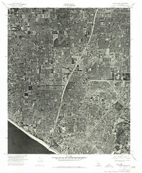
1974 Map of Costa Mesa
USGS Topo · Published 1975About this map
Costa Mesa and Fountain Valley are captured here in a transition point of mid-1970s development, shown through the detailed lens of a 1974 orthophotograph. This aerial survey provides a photographic record of the suburban expansion across Orange County, where residential grids and industrial tracts meet the natural curve of the Santa Ana River. The imagery reveals the density of the built environment just inland from the Pacific Ocean, documenting the precise footprint of streets and commercial centers in Westminster and its surrounding communities. By using actual photography rather than traditional topographic symbols, the map preserves a visual census of the landscape, from the specialized land use in the river valley to the burgeoning neighborhoods that would define the region's late-twentieth-century character.
Find a feature on this map
5 named features on this map. Tap any name to fly to it.
Don’t see what you’re looking for? This feature index may not catch every label — zoom into the map to look around manually.
Map Details
Editions of this 1974 Costa Mesa Map
This is the sole edition of this map. No revisions or reprints were ever made.
Other maps of this area

1896 · Santa Ana
USGS Topo · 1:62,500

1896 · Anaheim
USGS Topo · 1:62,500

1896 · Las Bolsas
USGS Topo · 1:62,500

1896 · Downey
USGS Topo · 1:62,500

1898 · Anaheim
USGS Topo · 1:62,500

1899 · Downey
USGS Topo · 1:62,500

1901 · Southern California Sheet No. 1
USGS Topo · 1:250,000

1901 · Santa Ana
USGS Topo · 1:62,500

1901 · Anaheim
USGS Topo · 1:62,500

1902 · Downey
USGS Topo · 1:62,500