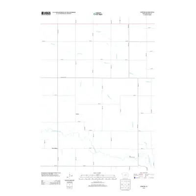
2013 Map of Coster
USGS Topo · Published 2013About this map
Coster and New Albion anchor this Butler County landscape, appearing as quiet rural communities situated within a grid of county roads and drainage systems. The W Fork Cedar River meanders across the southern portion of the sheet, characterized by its winding oxbows and the West Fork Forest Access conservation area. This 2013 survey illustrates the highly structured agricultural environment of northern Iowa, where the landscape is divided by a network of thoroughfares like Butler Center Rd and Quarry Ave. Several smaller watercourses, including McClure Cr, Moulfon Cr, and Landphere Cr, drain the surrounding farmland into the river basin. The map provides a clear record of modern property divisions and rural infrastructure, from the straight lines of Sinclair Ave to the natural curves of the river bottomlands.
Find a feature on this map
33 named features on this map. Tap any name to fly to it.
Don’t see what you’re looking for? This feature index may not catch every label — zoom into the map to look around manually.
Map Details
Editions of this 2013 Coster Map
This is the sole edition of this map. No revisions or reprints were ever made.
Other maps of this area

1954 · Waterloo
USGS Topo · 1:250,000

1955 · Waterloo
USGS Topo · 1:250,000

1971 · Shell Rock
USGS Topo · 1:24,000

1971 · Coster
USGS Topo · 1:24,000

1971 · Plainfield
USGS Topo · 1:24,000

1971 · Clarksville
USGS Topo · 1:24,000

1971 · Stout
USGS Topo · 1:24,000
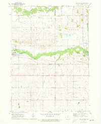
1971 · New Hartford
USGS Topo · 1:24,000

1972 · Allison
USGS Topo · 1:24,000

1979 · Butler Center
USGS Topo · 1:24,000