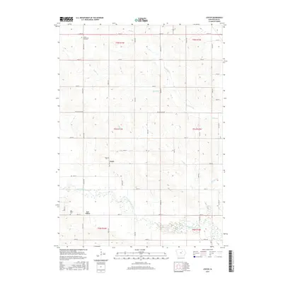
2015 Map of Coster
USGS Topo · Published 2015About this map
The West Fork Cedar River carves a meandering path through this rural Butler County landscape, shaping the terrain where smaller tributaries like Moulton Cr and McClure Creek drain the surrounding fields. This 2015 survey provides a clear view of the section-line road network that defines local geography, anchored by the crossroads at Coster and the nearby New Albion. For those looking into the area's social history, several significant sites are preserved in the data, including the Butler County Poor Farm Cem, a poignant marker of the county's historical approach to social welfare. The presence of both the Coster Cem and New Albion Cem alongside small settlements suggests a long-standing rural community structure that has persisted well into the twenty-first century.
Find a feature on this map
42 named features on this map. Tap any name to fly to it.
Don’t see what you’re looking for? This feature index may not catch every label — zoom into the map to look around manually.
Map Details
Editions of this 2015 Coster Map
This is the sole edition of this map. No revisions or reprints were ever made.
Other maps of this area

1954 · Waterloo
USGS Topo · 1:250,000

1955 · Waterloo
USGS Topo · 1:250,000

1971 · Shell Rock
USGS Topo · 1:24,000

1971 · Coster
USGS Topo · 1:24,000

1971 · Plainfield
USGS Topo · 1:24,000

1971 · Clarksville
USGS Topo · 1:24,000

1971 · Stout
USGS Topo · 1:24,000
1971 · New Hartford
USGS Topo · 1:24,000

1972 · Allison
USGS Topo · 1:24,000

1979 · Butler Center
USGS Topo · 1:24,000