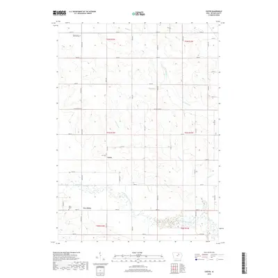
2018 Map of Coster
USGS Topo · Published 2018About this map
Coster and New Albion anchor this Butler County landscape, appearing here in the early 21st century as small agricultural clusters defined by their proximity to the meandering West Fork Cedar River. The river's broad floodplain dominates the southern portion of the sheet, while to the north, a network of tributaries including Landphere Cr, McClure Creek, and Moulfon Cr carve out the rolling Iowa farmland. Of particular interest to local historians is the Butler County Poor Farm Cem in the northwest, a poignant reminder of the county's social history. Other family or community markers include the New Albion Cem and Coster Cem. The region's geography is further shaped by a local Quarry and a strict grid of county roads such as Co Rd T55 and Butler Center Rd, which facilitate the transit of the area's agricultural output.
Find a feature on this map
44 named features on this map. Tap any name to fly to it.
Don’t see what you’re looking for? This feature index may not catch every label — zoom into the map to look around manually.
Map Details
Editions of this 2018 Coster Map
This is the sole edition of this map. No revisions or reprints were ever made.
Other maps of this area

1954 · Waterloo
USGS Topo · 1:250,000

1955 · Waterloo
USGS Topo · 1:250,000

1971 · Shell Rock
USGS Topo · 1:24,000

1971 · Coster
USGS Topo · 1:24,000

1971 · Plainfield
USGS Topo · 1:24,000

1971 · Clarksville
USGS Topo · 1:24,000

1971 · Stout
USGS Topo · 1:24,000
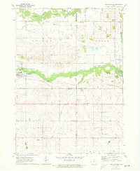
1971 · New Hartford
USGS Topo · 1:24,000

1972 · Allison
USGS Topo · 1:24,000

1979 · Butler Center
USGS Topo · 1:24,000