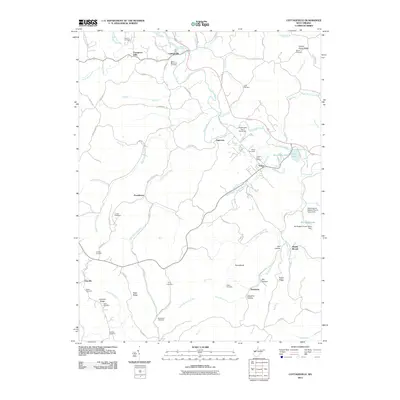
2011 Map of Cottageville
USGS Topo · Published 2011About this map
Cottageville and Evans serve as central nodes in this rural West Virginia landscape, where the Evans Post Office and Mount Moriah church anchor the local community. The terrain is defined by a dense network of winding waterways, including Mill Creek and Parchment Creek, alongside numerous named ridges like Parsons Ridge and Gunville Ridge. This 2011 survey reveals a high concentration of family and community burial grounds, such as Blaine Memorial Cemetery, Ankrum Cemetery, and Sayre Cemetery, which provide significant genealogical data for the region. The landscape is also marked by recreational and agricultural features, including Hutchison Lake, Rollins Lake, and the Wv Baptist Church Camp Dam on Big Horse Lake. Smaller settlements like Angerona and Gunville are connected by a web of local routes like Angerona-Hill Rd and Clarksburg Rd, reflecting the enduring rural character of Jackson County.
Find a feature on this map
108 named features on this map. Tap any name to fly to it.
Don’t see what you’re looking for? This feature index may not catch every label — zoom into the map to look around manually.
Map Details
Editions of this 2011 Cottageville Map
This is the sole edition of this map. No revisions or reprints were ever made.
Other maps of this area

1906 · Kenna
USGS Topo · 1:62,500

1906 · Winfield
USGS Topo · 1:62,500

1907 · Kenna
USGS Topo · 1:62,500

1907 · Ripley
USGS Topo · 1:62,500

1908 · Winfield
USGS Topo · 1:62,500

1908 · Ravenswood
USGS Topo · 1:62,500

1926 · Ravenswood
USGS Topo · 1:62,500

1926 · Ripley
USGS Topo · 1:62,500

1928 · Ravenswood
USGS Topo · 1:62,500

1928 · Ripley
USGS Topo · 1:62,500