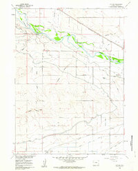
1960 Map of Cottier
USGS Topo · Published 1962About this map
The North Platte River corridors of Goshen County are defined here by a sophisticated irrigation network and layers of westward migration history. Tracing through the landscape is the Emigrant Trail, passing notable landmarks such as the Historical Mon and the site of Rock Ranch (Historical). This 1960 survey illustrates the transition from high plains to the fertile river bottom, where engineered waterways like the Fort Laramie Canal, North Platte Canal, and Rock Ranch Canal diverted water to support agriculture on the Flats.
Find a feature on this map
28 named features on this map. Tap any name to fly to it.
Don’t see what you’re looking for? This feature index may not catch every label — zoom into the map to look around manually.
Map Details
Editions of this 1960 Cottier Map
3 editions found
Other maps of this area

1896 · Patrick
USGS Topo · 1:125,000

1899 · Goshen Hole
USGS Topo · 1:125,000

1954 · Torrington
USGS Topo · 1:250,000

1954 · Cheyenne
USGS Topo · 1:250,000

1958 · Cheyenne
USGS Topo · 1:250,000

1958 · Torrington
USGS Topo · 1:250,000

1960 · Habig Spring
USGS Topo · 1:24,000

1960 · Huntley
USGS Topo · 1:24,000

1960 · Veteran
USGS Topo · 1:24,000
1960 · Barnes
USGS Topo · 1:24,000