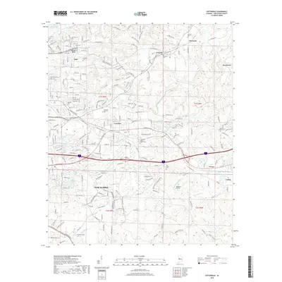
2018 Map of Cottondale
USGS Topo · Published 2018About this map
Hurricane Creek and the surrounding drainage basins of Cottondale Cr define the landscape just east of Tuscaloosa in this 2018 survey. The map details a transition from the industrial and residential corridors of South Holt and Holt toward the more dispersed settlements of Peterson, Fleetwood, and Brookwood. Infrastructure following the KCS railroad and the Interstate 20 59 corridor supports the region's economy, while landmarks like Prudes Mill Pond and the Gravel Pit near Grimes indicate local resource use. Numerous community sites, including Ruhama Church (Br) and the Cottondale Nature Garden Cem, are clearly marked for those researching family history in the area. The presence of William Bacon Oliver Lake and Holt Lake in the northwest corner highlights the importance of the Black Warrior River system to the local geography.
Find a feature on this map
79 named features on this map. Tap any name to fly to it.
Don’t see what you’re looking for? This feature index may not catch every label — zoom into the map to look around manually.
Map Details
Editions of this 2018 Cottondale Map
This is the sole edition of this map. No revisions or reprints were ever made.
Other maps of this area

1899 · Brookwood
USGS Topo · 1:125,000

1924 · Tuscaloosa
USGS Topo · 1:62,500

1926 · Samantha
USGS Topo · 1:48,000

1926 · Tuscaloosa
USGS Topo · 1:62,500

1928 · Samantha
USGS Topo · 1:62,500

1929 · Searles
USGS Topo · 1:48,000

1931 · Cottondale
USGS Topo · 1:48,000

1934 · Searles
USGS Topo · 1:62,500

1934 · Cottondale
USGS Topo · 1:62,500

1953 · Birmingham
USGS Topo · 1:250,000