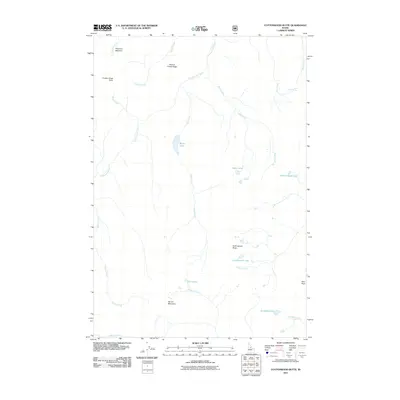
2011 Map of Cottonwood Butte
USGS Topo · Published 2011About this map
Cottonwood Butte and the surrounding high country of Idaho County define this 2011 survey, a landscape characterized by isolated mountain lakes and prominent ridges. The geography is shaped by the headwaters of numerous drainages, where Cottonwood Creek and Basin Creek flow through the deep-cut terrain. High-altitude meadows and springs, such as Phantom Meadow and Stub Creek Spring, offer distinct points of reference in an area marked by significant elevation changes between Farrow Mountain and the surrounding basins. This USGS study provides a contemporary view of these remote features, detailing the network of water bodies including Swamp Angel Lake, Black Lake, and Stoddard Lake. The map captures the hydrological patterns of the region, from the seasonal flow of Mirage Creek to the perennial Twin Lakes, illustrating the complex drainage systems that define this part of the Idaho wilderness.
Find a feature on this map
26 named features on this map. Tap any name to fly to it.
Don’t see what you’re looking for? This feature index may not catch every label — zoom into the map to look around manually.
Map Details
Editions of this 2011 Cottonwood Butte Map
This is the sole edition of this map. No revisions or reprints were ever made.
Other maps of this area

1956 · Elk City
USGS Topo · 1:250,000

1960 · Elk City
USGS Topo · 1:250,000

1962 · Vinegar Hill
USGS Topo · 1:24,000

1962 · Square Top
USGS Topo · 1:24,000

1962 · Papoose Peak
USGS Topo · 1:24,000

1962 · Aggipah Mtn
USGS Topo · 1:24,000

1962 · Butts Creek Point
USGS Topo · 1:24,000

1977 · Cottonwood Butte
USGS Topo · 1:24,000

1978 · Waugh Mountain
USGS Topo · 1:24,000

1978 · Devils Teeth Rapids
USGS Topo · 1:24,000