
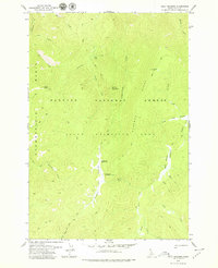
1962 Map of Papoose Peak
USGS Topo · Published 1964About this map
Papoose Peak and the high ridge of Black Butte anchor this high-elevation wilderness landscape where the Salmon National Forest meets the Payette National Forest. The 1962 survey illustrates a remote backcountry defined by a network of drainage systems and primitive routes, including the Coyote Springs Trail and the Stoddard Trail. An indefinite boundary separates Idaho and Valley counties, cutting across steep terrain marked by features like Big Hill and the waters of Papoose Lake. The drainage patterns are clearly delineated, showing the headwaters of numerous creeks including Trapper Creek, Golden Creek, and Wolf Creek, which flow through deep canyons and beneath prominent peaks like Farrow Mtn.
Find a feature on this map
25 named features on this map. Tap any name to fly to it.
Don’t see what you’re looking for? This feature index may not catch every label — zoom into the map to look around manually.
Map Details
Editions of this 1962 Papoose Peak Map
This is the sole edition of this map. No revisions or reprints were ever made.
Other maps of this area

1956 · Elk City
USGS Topo · 1:250,000

1960 · Elk City
USGS Topo · 1:250,000

1962 · Mormon Mtn
USGS Topo · 1:24,000

1962 · Vinegar Hill
USGS Topo · 1:24,000

1962 · Puddin Mtn
USGS Topo · 1:24,000

1962 · Aggipah Mtn
USGS Topo · 1:24,000

1962 · Dave Lewis Peak
USGS Topo · 1:24,000

1962 · Butts Creek Point
USGS Topo · 1:24,000

1977 · Cottonwood Butte
USGS Topo · 1:24,000
1979 · Cold Meadows
USGS Topo · 1:24,000