
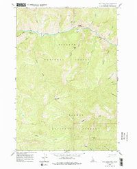
1962 Map of Dave Lewis Peak
USGS Topo · Published 1964About this map
Dave Lewis Peak anchors this wilderness landscape within the Idaho backcountry, where the Payette National Forest and Salmon National Forest meet. The 1962 survey reveals a remote network of trails and essential bush-pilot infrastructure like the Taylor Landing Field and a secondary Landing Field along the deep canyon of Big Creek. Cultural history is noted through specific landmarks along the river, including ancient Petroglyphs near the Big Creek Gorge and a lonely Grave at Soldier Bar. This area, deeply carved by drainages such as Sammy Gulch and Breeching Creek, shows evidence of mid-century activity with several Mines and the Short Creek Lookout positioned on the high ridges to the south.
Find a feature on this map
32 named features on this map. Tap any name to fly to it.
Don’t see what you’re looking for? This feature index may not catch every label — zoom into the map to look around manually.
Map Details
Editions of this 1962 Dave Lewis Peak Map
2 editions found
Other maps of this area

1930 · Casto
USGS Topo · 1:125,000

1956 · Elk City
USGS Topo · 1:250,000

1957 · Challis
USGS Topo · 1:250,000

1960 · Elk City
USGS Topo · 1:250,000

1960 · Challis
USGS Topo · 1:250,000

1962 · Mormon Mtn
USGS Topo · 1:24,000

1962 · Vinegar Hill
USGS Topo · 1:24,000

1962 · Bear Creek Point
USGS Topo · 1:24,000

1962 · Puddin Mtn
USGS Topo · 1:24,000

1962 · Papoose Peak
USGS Topo · 1:24,000