
1962 Map of Bear Creek Point
USGS Topo · Published 1963About this map
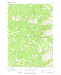
Bear Creek Point rises as a central landmark in this 1962 field-checked survey of the Idaho backcountry. The landscape is defined by the convergence of major wilderness tracts, with the National Forest Boundary separating the Salmon National Forest from the Boise National Forest in the southern portion of the quadrangle. The drainage patterns are intricate, characterized by the Middle Fk Salmon R along the eastern edge and a complex network of tributaries such as Sheep Creek and South Fork Brush Creek. This era of mapping shows the region prior to further modern designations, focusing on the natural topography and the primitive trail system. Researchers can trace the steep gulches and named peaks, including the uniquely titled Countess Gulch and Horn Creek, which provide insights into early naming conventions in Valley Co.
Find a feature on this map
18 named features on this map. Tap any name to fly to it.
Don’t see what you’re looking for? This feature index may not catch every label — zoom into the map to look around manually.
Map Details
Editions of this 1962 Bear Creek Point Map
2 editions found
Other maps of this area

1930 · Casto
USGS Topo · 1:125,000

1956 · Elk City
USGS Topo · 1:250,000

1957 · Challis
USGS Topo · 1:250,000

1960 · Elk City
USGS Topo · 1:250,000

1960 · Challis
USGS Topo · 1:250,000

1962 · Mormon Mtn
USGS Topo · 1:24,000

1962 · Puddin Mtn
USGS Topo · 1:24,000

1962 · Norton Ridge
USGS Topo · 1:24,000

1962 · Shellrock Peak
USGS Topo · 1:24,000

1962 · Dave Lewis Peak
USGS Topo · 1:24,000