
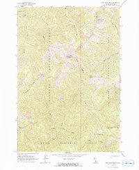
1962 Map of Shellrock Peak
USGS Topo · Published 1964About this map
Shellrock Peak serves as the prominent central landmark for this high-altitude section of the Idaho wilderness in the early 1960s. The map illustrates a complex convergence of jurisdictional boundaries, where the Payette National Forest, Salmon National Forest, and Boise National Forest all meet along high ridges and drainage divides. This landscape is defined by its water systems, including the headwaters of Telephone Creek and Rush Creek, and the isolated Norton Lake tucked below Norton Ridge in the southeastern corner. A solitary Trail is the primary evidence of human access through this steep terrain, connecting these three national forests. The presence of several triangulation stations, such as Lookout VABM 9435 at the summit of Shellrock Peak, highlights the surveying effort required to map this mountainous interior.
Find a feature on this map
24 named features on this map. Tap any name to fly to it.
Don’t see what you’re looking for? This feature index may not catch every label — zoom into the map to look around manually.
Map Details
Editions of this 1962 Shellrock Peak Map
2 editions found
Other maps of this area

1930 · Casto
USGS Topo · 1:125,000

1956 · Elk City
USGS Topo · 1:250,000

1957 · Challis
USGS Topo · 1:250,000

1960 · Elk City
USGS Topo · 1:250,000

1960 · Challis
USGS Topo · 1:250,000

1962 · Mormon Mtn
USGS Topo · 1:24,000

1962 · Bear Creek Point
USGS Topo · 1:24,000

1962 · Norton Ridge
USGS Topo · 1:24,000

1962 · Dave Lewis Peak
USGS Topo · 1:24,000

1962 · Ramey Hill
USGS Topo · 1:24,000