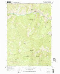
1962 Map of Dave Lewis Peak
USGS Topo · Published 1979About this map
Big Creek carves a deep path through this wilderness landscape, serving as the primary corridor for human activity along the northern portion of the sheet. The area is defined by the high-elevation divide between the Payette National Forest and the Salmon National Forest, rising to the namesake Dave Lewis Peak. Cultural markers are concentrated along the river floor, where Taylor Landing Field and Soldier Bar provide flat ground for access in an otherwise vertical environment.
Find a feature on this map
38 named features on this map. Tap any name to fly to it.
Don’t see what you’re looking for? This feature index may not catch every label — zoom into the map to look around manually.
Map Details
Editions of this 1962 Dave Lewis Peak Map
2 editions found

Other maps of this area

1930 · Casto
USGS Topo · 1:125,000

1956 · Elk City
USGS Topo · 1:250,000

1957 · Challis
USGS Topo · 1:250,000

1960 · Elk City
USGS Topo · 1:250,000

1960 · Challis
USGS Topo · 1:250,000

1962 · Mormon Mtn
USGS Topo · 1:24,000

1962 · Vinegar Hill
USGS Topo · 1:24,000

1962 · Bear Creek Point
USGS Topo · 1:24,000

1962 · Puddin Mtn
USGS Topo · 1:24,000

1962 · Papoose Peak
USGS Topo · 1:24,000