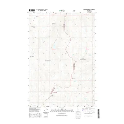
2013 Map of Cottonwood Butte
USGS Topo · Published 2013About this map
Cottonwood Butte stands as a prominent landmark within this high-elevation landscape of north-central Idaho, where the borders of the Payette National Forest and Salmon National Forest meet. This survey captures a network of alpine basins and ridges defined by numerous small water bodies, including Black Lake, Swamp Angel Lake, and Stoddard Lake. The drainage patterns are intricate, with headwaters such as Kitchen Cr and Papoose Cr carving through the terrain. The presence of several named meadows like Phantom Meadow and Lower Meadow suggests pockets of relatively level ground amidst the steep slopes of Canyon Creek Ridge and peaks like Farrow Mtn. This area is characterized by its hydrological density, featuring many named springs and creek systems that feed into the larger regional watersheds.
Find a feature on this map
35 named features on this map. Tap any name to fly to it.
Don’t see what you’re looking for? This feature index may not catch every label — zoom into the map to look around manually.
Map Details
Editions of this 2013 Cottonwood Butte Map
This is the sole edition of this map. No revisions or reprints were ever made.
Other maps of this area

1956 · Elk City
USGS Topo · 1:250,000

1960 · Elk City
USGS Topo · 1:250,000

1962 · Vinegar Hill
USGS Topo · 1:24,000

1962 · Square Top
USGS Topo · 1:24,000

1962 · Papoose Peak
USGS Topo · 1:24,000

1962 · Aggipah Mtn
USGS Topo · 1:24,000

1962 · Butts Creek Point
USGS Topo · 1:24,000

1977 · Cottonwood Butte
USGS Topo · 1:24,000

1978 · Waugh Mountain
USGS Topo · 1:24,000

1978 · Devils Teeth Rapids
USGS Topo · 1:24,000