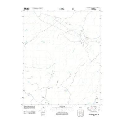
2011 Map of Cottonwood Canyon
USGS Topo · Published 2011About this map
Las Tusas Valley defines the northern reaches of this high-altitude landscape, where the drainage patterns of Cottonwood Creek and Sawyer Creek intersect with several deep canyons. This McKinley County terrain is marked by a network of ranching infrastructure, featuring established sites such as Irvin Ranch, Bass Ranch, and Coddington Ranch. The reliance on surface water management is evident through numerous named stock tanks like Rock Stock Tank, Thurlow Tank, and the Bill Morgan Tank, which supported livestock across the open range. Steep topographical breaks occur along the Lookout Mountain Rim, dropping into Peavine Canyon and Monighan Canyon. In the southern portion of the quadrangle, Rice Park and the Rice Park Dam provide a focal point for water catchment near Prairie Dog Tank, illustrating the essential relationship between the geography and the rural western ranching economy of the early 21st century.
Find a feature on this map
27 named features on this map. Tap any name to fly to it.
Don’t see what you’re looking for? This feature index may not catch every label — zoom into the map to look around manually.
Map Details
Editions of this 2011 Cottonwood Canyon Map
This is the sole edition of this map. No revisions or reprints were ever made.
Other maps of this area

1886 · Wingate
USGS Topo · 1:250,000

1892 · Wingate
USGS Topo · 1:250,000

1952 · Post Office Flat
USGS Topo · 1:24,000

1954 · Gallup
USGS Topo · 1:250,000

1958 · Gallup
USGS Topo · 1:250,000

1959 · Gallup
USGS Topo · 1:250,000

1961 · Cottonwood Canyon
USGS Topo · 1:24,000

1962 · Gallup
USGS Topo · 1:250,000

1962 · Ciniza
USGS Topo · 1:24,000

1962 · Continental Divide
USGS Topo · 1:24,000