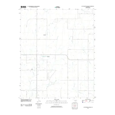
2010 Map of Cottonwood Creek
USGS Topo · Published 2010About this map
Dixie Cemetery serves as a focal point for genealogy in this corner of Carter County, situated among the undulating drainage basins of South Central Oklahoma. The landscape is defined by an intricate network of waterways, including the winding paths of Caddo Creek, Cottonwood Creek, and the curiously named Whisky Creek. These streams create a complex riparian pattern across the section lines, punctuated by man-made alterations like the Oknoname 137080 Reservoir and its associated dam.
Find a feature on this map
34 named features on this map. Tap any name to fly to it.
Don’t see what you’re looking for? This feature index may not catch every label — zoom into the map to look around manually.
Map Details
Editions of this 2010 Cottonwood Creek Map
This is the sole edition of this map. No revisions or reprints were ever made.
Other maps of this area

1901 · Addington
USGS Topo · 1:125,000

1901 · Ardmore
USGS Topo · 1:125,000

1918 · Ardmore
USGS Topo · 1:125,000

1957 · Ardmore
USGS Topo · 1:250,000

1963 · Ardmore
USGS Topo · 1:250,000

1969 · Healdton
USGS Topo · 1:24,000
1969 · Tatums
USGS Topo · 1:24,000
1969 · Fox
USGS Topo · 1:24,000

1974 · Ringling NW
USGS Topo · 1:24,000

1974 · Loco
USGS Topo · 1:24,000