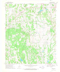
1969 Map of Tatums
USGS Topo · Published 1971About this map
Tatums serves as a focal point for this late 1960s study of Carter County, situated within a landscape shaped by the Arbuckle Mountains and the extensive Oil Field operations of the era. The mapping details a network of family and community history preserved in sites like the Tatums Cem, Old Monk Cem, and Oil Spring Cem. Water defines the local boundaries, from the northern flow of Wildhorse Creek to the southern reach of Caddo Creek, interspersed with numerous spillways and reservoirs such as Spillway Elev 951. The presence of small settlements like Pooleville and Alpers, alongside the Pilgrim Ch, reflects the rural social structure during a time when gravel pits and petroleum extraction drove the local economy. The detailed inclusion of fence and field lines provides a unique look at the land divisions and property boundaries that characterized this portion of southern Oklahoma.
Find a feature on this map
27 named features on this map. Tap any name to fly to it.
Don’t see what you’re looking for? This feature index may not catch every label — zoom into the map to look around manually.
Map Details
Editions of this 1969 Tatums Map
2 editions found
Other maps of this area

1898 · Pauls Valley
USGS Topo · 1:125,000

1901 · Addington
USGS Topo · 1:125,000

1901 · Ardmore
USGS Topo · 1:125,000

1902 · Pauls Valley
USGS Topo · 1:125,000

1902 · Rush Springs
USGS Topo · 1:125,000

1918 · Ardmore
USGS Topo · 1:125,000

1957 · Ardmore
USGS Topo · 1:250,000

1963 · Ardmore
USGS Topo · 1:250,000

1968 · Fox NE
USGS Topo · 1:24,000

1969 · Hennepin
USGS Topo · 1:24,000