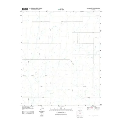
2012 Map of Cottonwood Creek
USGS Topo · Published 2012About this map
Dixie Cem serves as a central landmark in this rural landscape north of Healdton, where a grid of section roads defines the modern boundaries of Southern Oklahoma. The terrain is deeply etched by a complex drainage system, including the prominent Cottonwood Cr and its tributaries such as Whisky Cr and N Mud Cr. This 2012 survey illustrates the transition from traditional agricultural land use to a modern infrastructure characterized by named corridors like W Oil City Rd and Pickelsimer Rd. In the northern reaches, the meandering Caddo Cr creates a natural break in the otherwise orderly road network, while the eastern portion is defined by the winding course of Walnut Cr. The map preserves the specific locations of rural crossroads and family-named thoroughfares such as Claxton Rd and Bryant Blvd, reflecting the local history of Carter County.
Find a feature on this map
29 named features on this map. Tap any name to fly to it.
Don’t see what you’re looking for? This feature index may not catch every label — zoom into the map to look around manually.
Map Details
Editions of this 2012 Cottonwood Creek Map
This is the sole edition of this map. No revisions or reprints were ever made.
Other maps of this area

1901 · Addington
USGS Topo · 1:125,000

1901 · Ardmore
USGS Topo · 1:125,000

1918 · Ardmore
USGS Topo · 1:125,000

1957 · Ardmore
USGS Topo · 1:250,000

1963 · Ardmore
USGS Topo · 1:250,000

1969 · Healdton
USGS Topo · 1:24,000
1969 · Tatums
USGS Topo · 1:24,000
1969 · Fox
USGS Topo · 1:24,000

1974 · Ringling NW
USGS Topo · 1:24,000

1974 · Loco
USGS Topo · 1:24,000