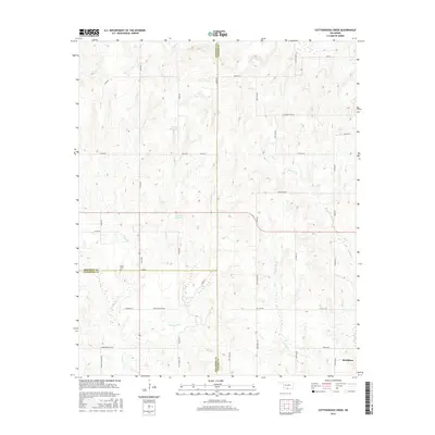
2016 Map of Cottonwood Creek
USGS Topo · Published 2016About this map
The rolling oil lands of southern Oklahoma converge where Carter, Stephens, and Jefferson counties meet, a region defined by complex drainage patterns and the infrastructure of the energy industry. Whisky Cr, Cottonwood Cr, and N Mud Cr weave through this landscape, while numerous unnamed petroleum wells and tanks are linked by a dense grid of rural roads. Names like Oil City Rd, Arco Rd, and Empire Rd point to the area's long-standing connection to the petroleum sector, while the northern edge of Healdton appears in the southeast corner. Local history and genealogy interests are centered at Dixie Cem and along family-named thoroughfares such as Thompson Ln and Fred Wilson Blvd, illustrating the enduring residential patterns of this rural territory.
Find a feature on this map
44 named features on this map. Tap any name to fly to it.
Don’t see what you’re looking for? This feature index may not catch every label — zoom into the map to look around manually.
Map Details
Editions of this 2016 Cottonwood Creek Map
This is the sole edition of this map. No revisions or reprints were ever made.
Other maps of this area

1901 · Addington
USGS Topo · 1:125,000

1901 · Ardmore
USGS Topo · 1:125,000

1918 · Ardmore
USGS Topo · 1:125,000

1957 · Ardmore
USGS Topo · 1:250,000

1963 · Ardmore
USGS Topo · 1:250,000

1969 · Healdton
USGS Topo · 1:24,000
1969 · Tatums
USGS Topo · 1:24,000
1969 · Fox
USGS Topo · 1:24,000

1974 · Ringling NW
USGS Topo · 1:24,000

1974 · Loco
USGS Topo · 1:24,000