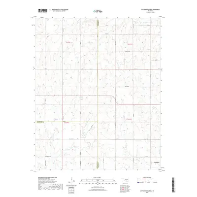
2018 Map of Cottonwood Creek
USGS Topo · Published 2018About this map
The town of Healdton sits at the eastern edge of this modern survey, where the drainages of Walnut Cr and Whisky Cr shape the terrain. This landscape is defined by its complex hydrography, featuring numerous unnamed impoundments and named bodies like 137058 Reservoir and 137080 Reservoir. The road network reflects a history of transit and land division, with routes such as Mail Route Rd, Oil City Rd, and the curiously named Convict Hill Rd cutting across the tri-county corner of Stephens, Carter, and Jefferson. For those researching local history, the Dixie Cem remains a significant landmark near the center of the sheet. The area is characterized by these small creek valleys, including Cottonwood Cr and N Mud Cr, which meander between hills marked by family-named thoroughfares like Rumsey Smith Blvd and Fred Wilson Blvd.
Find a feature on this map
48 named features on this map. Tap any name to fly to it.
Don’t see what you’re looking for? This feature index may not catch every label — zoom into the map to look around manually.
Map Details
Editions of this 2018 Cottonwood Creek Map
This is the sole edition of this map. No revisions or reprints were ever made.
Other maps of this area

1901 · Addington
USGS Topo · 1:125,000

1901 · Ardmore
USGS Topo · 1:125,000

1918 · Ardmore
USGS Topo · 1:125,000

1957 · Ardmore
USGS Topo · 1:250,000

1963 · Ardmore
USGS Topo · 1:250,000

1969 · Healdton
USGS Topo · 1:24,000
1969 · Tatums
USGS Topo · 1:24,000
1969 · Fox
USGS Topo · 1:24,000

1974 · Ringling NW
USGS Topo · 1:24,000

1974 · Loco
USGS Topo · 1:24,000