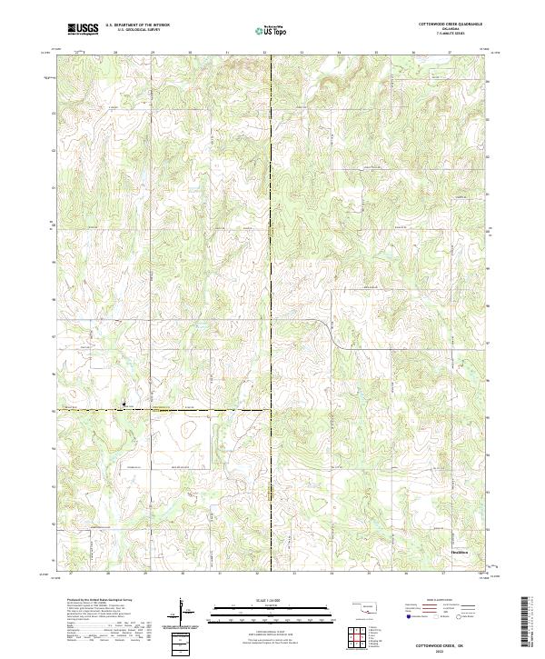
2022 Map of Cottonwood Creek
USGS Topo · Published 2022About this map
Healdton anchors the southeastern corner of this landscape where the boundaries of Carter, Stephens, and Jefferson counties converge. The terrain is defined by a dense network of intermittent drainages, most notably Cottonwood Cr and Whisky Cr, which carve through the plains. This area reflects a deep history of rural land division and transport, evidenced by local routes like Mail Route Rd, Convict Hill Rd, and No Man Rd.
Find a feature on this map
48 named features on this map. Tap any name to fly to it.
Don’t see what you’re looking for? This feature index may not catch every label — zoom into the map to look around manually.
Map Details
Editions of this 2022 Cottonwood Creek Map
This is the sole edition of this map. No revisions or reprints were ever made.
Other maps of this area

1901 · Addington
USGS Topo · 1:125,000

1901 · Ardmore
USGS Topo · 1:125,000

1918 · Ardmore
USGS Topo · 1:125,000

1957 · Ardmore
USGS Topo · 1:250,000

1963 · Ardmore
USGS Topo · 1:250,000

1969 · Healdton
USGS Topo · 1:24,000
1969 · Tatums
USGS Topo · 1:24,000
1969 · Fox
USGS Topo · 1:24,000

1974 · Ringling NW
USGS Topo · 1:24,000

1974 · Loco
USGS Topo · 1:24,000