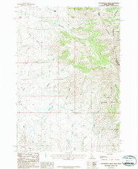
1987 Map of Cottonwood Creek
USGS Topo · Published 1987About this map
The Continental Divide winds through the high elevation of the Beaverhead Mountains along the Idaho-Montana border in this late-twentieth-century study. This high-altitude landscape is defined by the headwaters of numerous drainages, with Eighteenmile Creek and McGinty Creek carving paths through the northern sections, while Cottonwood Creek and Mud Creek drain the southwestern slopes. The map illustrates the administrative overlap of the Beaverhead National Forest and Targhee National Forest meeting at the state line.
Find a feature on this map
28 named features on this map. Tap any name to fly to it.
Don’t see what you’re looking for? This feature index may not catch every label — zoom into the map to look around manually.
Map Details
Editions of this 1987 Cottonwood Creek Map
This is the sole edition of this map. No revisions or reprints were ever made.
Other maps of this area

1955 · Dubois
USGS Topo · 1:250,000

1956 · Morrison Lake
USGS Topo · 1:62,500

1956 · Nicholia
USGS Topo · 1:62,500

1957 · Scott Peak
USGS Topo · 1:62,500

1958 · Dubois
USGS Topo · 1:250,000

1965 · Island Butte
USGS Topo · 1:24,000

1980 · Leadore
USGS Topo · 1:100,000

1983 · Dubois
USGS Topo · 1:100,000
1987 · Eighteenmile Peak
USGS Topo · 1:24,000
1987 · Morrison Lake
USGS Topo · 1:24,000