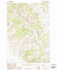
1987 Map of Morrison Lake
USGS Topo · Published 1987About this map
The Continental Divide serves as the high-altitude backbone of this 1987 survey, marking the intersection of Salmon National Forest and Beaverhead National Forest along the Idaho-Montana border. The landscape is defined by its drainage systems and mining activity, notably an Open Pit Mine and several Prospects situated in the western portion of the sheet. These sites, located near Clear Creek and Poison Creek, indicate a history of resource extraction in this high-elevation terrain.
Find a feature on this map
27 named features on this map. Tap any name to fly to it.
Don’t see what you’re looking for? This feature index may not catch every label — zoom into the map to look around manually.
Map Details
Editions of this 1987 Morrison Lake Map
This is the sole edition of this map. No revisions or reprints were ever made.
Other maps of this area

1955 · Dubois
USGS Topo · 1:250,000

1956 · Morrison Lake
USGS Topo · 1:62,500

1956 · Nicholia
USGS Topo · 1:62,500

1957 · Scott Peak
USGS Topo · 1:62,500

1958 · Dubois
USGS Topo · 1:250,000

1965 · Graphite Mountain
USGS Topo · 1:24,000

1965 · Island Butte
USGS Topo · 1:24,000

1980 · Leadore
USGS Topo · 1:100,000

1983 · Dubois
USGS Topo · 1:100,000
1987 · Eighteenmile Peak
USGS Topo · 1:24,000