
1965 Map of Graphite Mountain
USGS Topo · Published 1968About this map
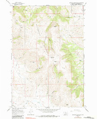
Graphite Mountain rises at the center of this 1960s topographic survey of the Beaverhead National Forest, a landscape defined by sharp drainage basins and high peaks. The region is marked by an extensive network of water sources, including West Kate Creek Spring, Johnson Spring, and Hewlett Spring, which likely supported local ranching or mining operations in the mid-20th century. Evidence of mineral exploration appears in the form of several Prospect and Prospects notations scattered throughout the southern canyons.
Find a feature on this map
38 named features on this map. Tap any name to fly to it.
Don’t see what you’re looking for? This feature index may not catch every label — zoom into the map to look around manually.
Map Details
Editions of this 1965 Graphite Mountain Map
2 editions found
Other maps of this area

1955 · Dubois
USGS Topo · 1:250,000

1956 · Morrison Lake
USGS Topo · 1:62,500

1958 · Dubois
USGS Topo · 1:250,000

1965 · Kidd
USGS Topo · 1:24,000

1965 · Caboose Canyon
USGS Topo · 1:24,000

1965 · Deer Canyon
USGS Topo · 1:24,000
1965 · Medicine Lodge Peak
USGS Topo · 1:24,000

1965 · Dixon Mountain
USGS Topo · 1:24,000

1965 · Island Butte
USGS Topo · 1:24,000

1980 · Leadore
USGS Topo · 1:100,000