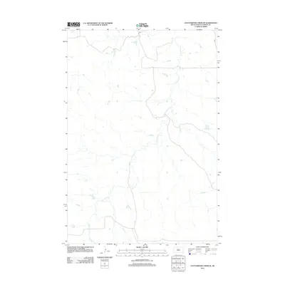
2012 Map of Cottonwood Creek SE
USGS Topo · Published 2012About this map
Cottonwood Creek defines the drainage of this portion of the Rock Creek District within the Standing Rock Reservation area of Corson County. This landscape is characterized by its sparse infrastructure, where the winding watercourse provides the primary geographical orientation. The topography is etched by the creek's seasonal flows, creating a network of draws and plateaus. Transport in the region is limited to a few secondary routes, including the local Co Rd, which navigates the higher ground above the stream beds. The map reflects a modern period of rural land management, highlighting the intersection of natural hydrology and the minimal road network that services the ranching or tribal lands of this South Dakota expanse.
Find a feature on this map
2 named features on this map. Tap any name to fly to it.
Don’t see what you’re looking for? This feature index may not catch every label — zoom into the map to look around manually.
Map Details
Editions of this 2012 Cottonwood Creek SE Map
This is the sole edition of this map. No revisions or reprints were ever made.
Other maps of this area

1953 · McIntosh
USGS Topo · 1:250,000

1956 · Black Horse SW
USGS Topo · 1:24,000

1956 · Cottonwood Creek NE
USGS Topo · 1:24,000

1956 · Black Horse
USGS Topo · 1:24,000

1956 · Cottonwood Creek SE
USGS Topo · 1:24,000

1956 · Cottonwood Creek NW
USGS Topo · 1:24,000

1956 · Cottonwood Creek SW
USGS Topo · 1:24,000

1958 · McIntosh
USGS Topo · 1:250,000

1978 · Isabel
USGS Topo · 1:24,000

1980 · McIntosh
USGS Topo · 1:100,000