
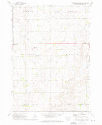
1973 Map of Cottonwood Lake
USGS Topo · Published 1976About this map
The rolling prairies of the Hand Co Jerauld Co border country are defined by a network of seasonal wetlands and glacial lakes, including Spring Lake and Cottonwood Lake. This 1973 survey shows a sparse agricultural landscape where social life and essential services are marked by isolated landmarks like the Townhall and a Radio Tower. Local history is anchored by the New Zion Cem located centrally near the county line, providing a point of reference for family researchers in this rural district. The southeastern corner of the map is dominated by the National Waterfowl Production Area, reflecting the importance of conservation and natural resource management in the South Dakota plains. The map also includes the townships of Marlar and Harmony, indicating the formal land divisions that shaped early settlement patterns.
Find a feature on this map
10 named features on this map. Tap any name to fly to it.
Don’t see what you’re looking for? This feature index may not catch every label — zoom into the map to look around manually.
Map Details
Editions of this 1973 Cottonwood Lake Map
This is the sole edition of this map. No revisions or reprints were ever made.
Other maps of this area

1949 · Vayland SE
USGS Topo · 1:24,000

1949 · Vayland SW
USGS Topo · 1:24,000

1951 · Vayland SW
USGS Topo · 1:24,000

1951 · Wessington SW
USGS Topo · 1:24,000

1951 · Vayland SE
USGS Topo · 1:24,000

1953 · Huron
USGS Topo · 1:250,000

1954 · Huron
USGS Topo · 1:250,000

1973 · Gannvalley
USGS Topo · 1:24,000

1973 · Wessington Springs NW
USGS Topo · 1:24,000
1973 · Wessington Springs SW
USGS Topo · 1:24,000