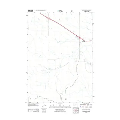
2012 Map of Cottonwood SW
USGS Topo · Published 2012About this map
Badlands National Park defines the southern portion of this landscape, where the prairie breaks into the sharp relief of Cedar Pass and Millard Ridge. The northern reaches are anchored by Cactus Flat, a notable junction point on the edge of the high plains. Between these landmarks, a series of seasonal drainages including Big Buffalo Cr, Rake Cr, and Sixteenmile Cr carve through the terrain, illustrating the complex erosional patterns typical of this region. The map also records localized topographical features such as Big Foot Hill, providing a detailed look at the rural road network, including CH 11 and Co RD S 8, which connect isolated ranchlands and public land boundaries during the early 21st century.
Find a feature on this map
13 named features on this map. Tap any name to fly to it.
Don’t see what you’re looking for? This feature index may not catch every label — zoom into the map to look around manually.
Map Details
Editions of this 2012 Cottonwood SW Map
This is the sole edition of this map. No revisions or reprints were ever made.
Other maps of this area

1950 · Interior
USGS Topo · 1:24,000

1951 · School Section Butte
USGS Topo · 1:24,000

1952 · Conata NE
USGS Topo · 1:24,000

1955 · Hot Springs
USGS Topo · 1:250,000

1955 · Martin
USGS Topo · 1:250,000

1958 · Martin
USGS Topo · 1:250,000

1960 · Wall SE
USGS Topo · 1:24,000

1960 · Cottonwood SW
USGS Topo · 1:24,000

1961 · Cottonwood
USGS Topo · 1:24,000

1961 · Cottonwood NE
USGS Topo · 1:24,000