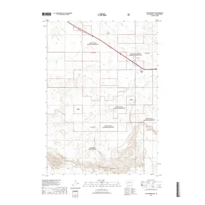
2017 Map of Cottonwood SW
USGS Topo · Published 2017About this map
Minuteman Missile National Historic Site stands as a Cold War landmark along the northern edge of this West River landscape, situated just north of Cactus Flat near the intersection of Hwy 16 and the interstate. The terrain is defined by the stark transition from the open expanses of Buffalo Gap National Grassland into the intricate eroded formations of Badlands National Park to the south. Prominent physical landmarks such as Big Foot Hill rise in the north, while the southern boundary reveals the complex topography of Cedar Pass and Millard Ridge. This map documents a unique intersection of military history and protected natural wilderness, where intermittent drainages like Big Buffalo Cr and Sixteenmile Cr carve through the sedimentary layers of the plains.
Find a feature on this map
19 named features on this map. Tap any name to fly to it.
Don’t see what you’re looking for? This feature index may not catch every label — zoom into the map to look around manually.
Map Details
Editions of this 2017 Cottonwood SW Map
This is the sole edition of this map. No revisions or reprints were ever made.
Other maps of this area

1950 · Interior
USGS Topo · 1:24,000

1951 · School Section Butte
USGS Topo · 1:24,000

1952 · Conata NE
USGS Topo · 1:24,000

1955 · Hot Springs
USGS Topo · 1:250,000

1955 · Martin
USGS Topo · 1:250,000

1958 · Martin
USGS Topo · 1:250,000

1960 · Wall SE
USGS Topo · 1:24,000

1960 · Cottonwood SW
USGS Topo · 1:24,000

1961 · Cottonwood
USGS Topo · 1:24,000

1961 · Cottonwood NE
USGS Topo · 1:24,000