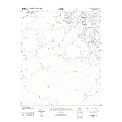
2012 Map of Cottonwood
USGS Topo · Published 2012About this map
The growing community of Cottonwood and the residential layout of Verde Village anchor this survey of the Verde Valley, documenting the area's development alongside its long-standing ranching and mining roots. The landscape transitions from the developed streets of Clemenceau and the Yavapai College Verde Valley Campus to the steep drainages of Hull Canyon and Gaddes Canyon near the hillside town of Jerome. Dozens of mountain springs, such as Baltimore Spring and Copper Chief Spring, highlight the critical role of water management in this arid terrain, as do numerous stock tanks like Montezuma Tank and Goddard Tank Number Two. The map detail traces the shift from traditional land uses at Blue Ranch to more modern infrastructure, including the Cottonwood Airport and the complex web of forest roads like fr360 that provide access to the surrounding peaks and the Mingus Mountain Campground.
Find a feature on this map
89 named features on this map. Tap any name to fly to it.
Don’t see what you’re looking for? This feature index may not catch every label — zoom into the map to look around manually.
Map Details
Editions of this 2012 Cottonwood Map
This is the sole edition of this map. No revisions or reprints were ever made.
Other maps of this area

1887 · Verde
USGS Topo · 1:250,000

1887 · Prescott
USGS Topo · 1:250,000

1892 · Verde
USGS Topo · 1:250,000

1892 · Prescott
USGS Topo · 1:250,000

1905 · Jerome
USGS Topo · 1:125,000

1923 · Camp Verde
USGS Topo · 1:125,000

1932 · Camp Verde
USGS Topo · 1:125,000

1936 · Camp Verde
USGS Topo · 1:125,000

1944 · Clarkdale
USGS Topo · 1:48,000

1944 · Mingus Mountain
USGS Topo · 1:62,500