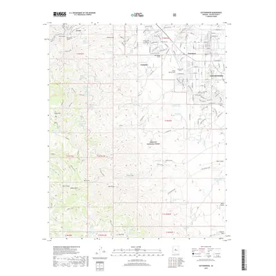
2018 Map of Cottonwood
USGS Topo · Published 2018About this map
Jerome and Clarkdale anchor this look at the eastern slopes of the Black Hills, where high-elevation landmarks give way to the developing valley below. The survey shows the urban interface between the historic mining town of Jerome, situated near Hull Canyon and Deception Gulch, and the industrial planned community of Clarkdale. Lower in the valley, the settlement of Clemenceau sits adjacent to the Yavapai College - Verde Valley Campus and the Cottonwood Airport. The landscape is defined by its water resources, with numerous named springs such as Copper Chief Spring, Baltimore Spring, and Hasket Spring scattered throughout the Prescott National Forest. The transition from the steep terrain of Mingus Mtn to the alluvial fans of Oak Wash reveals the complex drainage patterns that have shaped local development and land use in this part of Yavapai County.
Find a feature on this map
149 named features on this map. Tap any name to fly to it.
Don’t see what you’re looking for? This feature index may not catch every label — zoom into the map to look around manually.
Map Details
Editions of this 2018 Cottonwood Map
This is the sole edition of this map. No revisions or reprints were ever made.
Other maps of this area

1887 · Verde
USGS Topo · 1:250,000

1887 · Prescott
USGS Topo · 1:250,000

1892 · Verde
USGS Topo · 1:250,000

1892 · Prescott
USGS Topo · 1:250,000

1905 · Jerome
USGS Topo · 1:125,000

1923 · Camp Verde
USGS Topo · 1:125,000

1932 · Camp Verde
USGS Topo · 1:125,000

1936 · Camp Verde
USGS Topo · 1:125,000

1944 · Clarkdale
USGS Topo · 1:48,000

1944 · Mingus Mountain
USGS Topo · 1:62,500