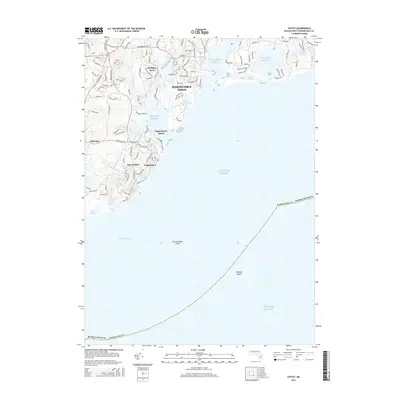
2015 Map of Cotuit
USGS Topo · Published 2015About this map
Barnstable Town and the neighboring coastal communities of Mashpee Neck and Popponesset characterize this 2015 survey of the Cape Cod shoreline. The landscape is defined by its intricate water systems, where the Mashpee River feeds into the Atlantic Ocean and numerous small bodies of water like Rushy Marsh Pond, Lewis Pond, and Witch Pond dot the residential landscape. The map reveals the modern development of coastal neighborhoods, showing the complex road networks of New Seabury and Seabrook reaching toward the Vineyard Sound. Off the coast, the topography extends underwater to include hazards and navigational markers such as Succonnesset Shoal and Eldridge Shoal. This geographic layout highlights the delicate balance between the area's dense residential expansion and its tidal wetlands and protected coves like Anns Cove.
Find a feature on this map
103 named features on this map. Tap any name to fly to it.
Don’t see what you’re looking for? This feature index may not catch every label — zoom into the map to look around manually.
Map Details
Editions of this 2015 Cotuit Map
This is the sole edition of this map. No revisions or reprints were ever made.
Other maps of this area

1886 · Falmouth
USGS Topo · 1:62,500

1887 · Muskeget
USGS Topo · 1:62,500

1887 · Marthas Vineyard
USGS Topo · 1:62,500

1888 · Barnstable
USGS Topo · 1:62,500

1888 · Falmouth
USGS Topo · 1:62,500

1889 · Muskeget
USGS Topo · 1:62,500

1889 · Marthas Vineyard
USGS Topo · 1:62,500

1893 · Muskeget
USGS Topo · 1:62,500

1893 · Barnstable
USGS Topo · 1:62,500

1893 · Falmouth
USGS Topo · 1:62,500