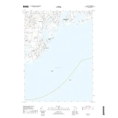
2018 Map of Cotuit
USGS Topo · Published 2018About this map
Mashpee Neck and the surrounding coastal communities define this landscape where freshwater systems meet the sound. The intricate coastline is shaped by the Mashpee River and Santuit River, which flow south toward Popponesset Island and the open Atlantic Ocean. This survey details the modern residential layout of New Seabury and Popponesset, highlighting a transition from maritime utility to established seaside neighborhoods.
Find a feature on this map
119 named features on this map. Tap any name to fly to it.
Don’t see what you’re looking for? This feature index may not catch every label — zoom into the map to look around manually.
Map Details
Editions of this 2018 Cotuit Map
This is the sole edition of this map. No revisions or reprints were ever made.
Other maps of this area

1886 · Falmouth
USGS Topo · 1:62,500

1887 · Muskeget
USGS Topo · 1:62,500

1887 · Marthas Vineyard
USGS Topo · 1:62,500

1888 · Barnstable
USGS Topo · 1:62,500

1888 · Falmouth
USGS Topo · 1:62,500

1889 · Muskeget
USGS Topo · 1:62,500

1889 · Marthas Vineyard
USGS Topo · 1:62,500

1893 · Muskeget
USGS Topo · 1:62,500

1893 · Barnstable
USGS Topo · 1:62,500

1893 · Falmouth
USGS Topo · 1:62,500