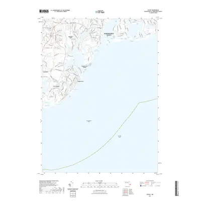
2021 Map of Cotuit
USGS Topo · Published 2021About this map
Mashpee Neck and the surrounding coastal developments define this modern landscape where the Mashpee River and Santuit River meet the sound. The map illustrates a densely settled shoreline characterized by planned communities like New Seabury and Popponesset, contrasting with the expansive natural preservation of the Fullers Marsh and Great River Marshes. This 2021 survey details the intricate network of residential ways and drives that have transformed the historic neck, while still identifying landmarks such as Anns Cove and Popponesset Island. Offshore, the mapping extends to underwater hazards including Succonnesset Shoal and Eldridge Shoal, which continue to be vital data points for local maritime navigation along this stretch of Barnstable County.
Find a feature on this map
121 named features on this map. Tap any name to fly to it.
Don’t see what you’re looking for? This feature index may not catch every label — zoom into the map to look around manually.
Map Details
Editions of this 2021 Cotuit Map
This is the sole edition of this map. No revisions or reprints were ever made.
Other maps of this area

1886 · Falmouth
USGS Topo · 1:62,500

1887 · Muskeget
USGS Topo · 1:62,500

1887 · Marthas Vineyard
USGS Topo · 1:62,500

1888 · Barnstable
USGS Topo · 1:62,500

1888 · Falmouth
USGS Topo · 1:62,500

1889 · Muskeget
USGS Topo · 1:62,500

1889 · Marthas Vineyard
USGS Topo · 1:62,500

1893 · Muskeget
USGS Topo · 1:62,500

1893 · Barnstable
USGS Topo · 1:62,500

1893 · Falmouth
USGS Topo · 1:62,500