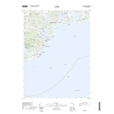
2023 Map of Cotuit
USGS Topo · Published 2023About this map
Mashpee National Wildlife Refuge anchors the western side of this coastal landscape, protecting the delicate transition between the Mashpee River and the open waters of the Atlantic Ocean. The geography is defined by a series of long, south-reaching peninsulas and sheltered embayments, such as Shoestring Bay and Popponesset Bay. These coastal features have fostered distinct residential enclaves, from the established village of Cotuit and the historic neighborhood of Wianno to the planned layout of New Seabury.
Find a feature on this map
112 named features on this map. Tap any name to fly to it.
Don’t see what you’re looking for? This feature index may not catch every label — zoom into the map to look around manually.
Map Details
Editions of this 2023 Cotuit Map
This is the sole edition of this map. No revisions or reprints were ever made.
Other maps of this area

1886 · Falmouth
USGS Topo · 1:62,500

1887 · Muskeget
USGS Topo · 1:62,500

1887 · Marthas Vineyard
USGS Topo · 1:62,500

1888 · Barnstable
USGS Topo · 1:62,500

1888 · Falmouth
USGS Topo · 1:62,500

1889 · Muskeget
USGS Topo · 1:62,500

1889 · Marthas Vineyard
USGS Topo · 1:62,500

1893 · Muskeget
USGS Topo · 1:62,500

1893 · Barnstable
USGS Topo · 1:62,500

1893 · Falmouth
USGS Topo · 1:62,500