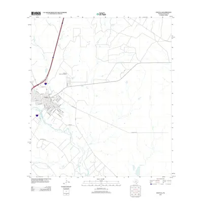
2013 Map of Cotulla
USGS Topo · Published 2013About this map
The town of Cotulla serves as the primary center of activity in this South Texas landscape, positioned where the Nueces River and Mustang Cr converge. The town's grid is dense with named streets such as Center St, Rio Grande, and S Baylor, reflecting its role as a regional hub. To the north, the Cotulla-La Salle County Airport and the corridor of the I-35 Bus Loop define the modern transportation infrastructure, while the surrounding brushland is carved by a network of drainage systems including Elm Cr, Altita Cr, and Lewis Cr. South of the town, the Allerkamp Reservoir sits within the lower river basin, suggesting the importance of water management in this arid environment. The map details a transition from concentrated residential blocks to open ranchland and utility corridors, characteristic of La Salle County's late twentieth-century development.
Find a feature on this map
48 named features on this map. Tap any name to fly to it.
Don’t see what you’re looking for? This feature index may not catch every label — zoom into the map to look around manually.
Map Details
Editions of this 2013 Cotulla Map
This is the sole edition of this map. No revisions or reprints were ever made.
Other maps of this area

1927 · Bart
USGS Topo · 1:62,500

1929 · Cotulla
USGS Topo · 1:125,000

1940 · Cotulla
USGS Topo · 1:62,500

1940 · Artesia Wells
USGS Topo · 1:62,500

1942 · Dilley
USGS Topo · 1:62,500

1953 · Crystal City
USGS Topo · 1:250,000

1955 · Crystal City
USGS Topo · 1:250,000

1956 · Woodward
USGS Topo · 1:62,500

1961 · Crystal City
USGS Topo · 1:250,000

1968 · Crystal City
USGS Topo · 1:250,000