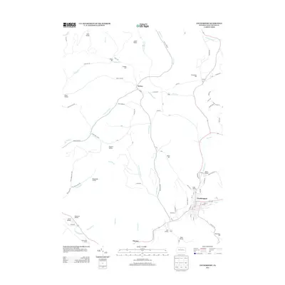
2013 Map of Coudersport
USGS Topo · Published 2013About this map
The Allegheny River winds through the southern portion of this Potter County landscape, anchoring the borough of Coudersport. This 2013 survey illustrates the modern layout of the county seat, where Mill Cr joins the river near a network of local streets and bridges. North of the river, the terrain rises into a series of named summits and hollows, including Negro Hill and Crandal Hill, reflecting a landscape deeply shaped by its many tributaries.
Find a feature on this map
93 named features on this map. Tap any name to fly to it.
Don’t see what you’re looking for? This feature index may not catch every label — zoom into the map to look around manually.
Map Details
Editions of this 2013 Coudersport Map
This is the sole edition of this map. No revisions or reprints were ever made.
Other maps of this area

1932 · Genesee
USGS Topo · 1:62,500

1934 · Coudersport
USGS Topo · 1:48,000

1937 · Genesee
USGS Topo · 1:62,500

1938 · Coudersport
USGS Topo · 1:62,500

1947 · Conrad
USGS Topo · 1:62,500

1947 · Ayers Hill
USGS Topo · 1:24,000

1948 · Emporium
USGS Topo · 1:62,500

1948 · Keating Summit
USGS Topo · 1:24,000
1948 · Austin
USGS Topo · 1:24,000
1949 · Ayers Hill
USGS Topo · 1:24,000
Featured Places
- Roulette Township, PA
- Hebron Township, PA
- Clara Township, PA
- Olmsted, Eulalia Township
- Eulalia Township, PA