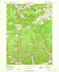
1948 Map of Austin
USGS Topo · Published 1965About this map
Austin sits at the southern convergence of the West Branch Freeman Run and the main branch of Freeman Run, serving as a primary hub for this Potter County landscape in the years following the Second World War. The topography is defined by a dense network of hollows and runs, many bearing family names like Cochrane Hol, Donovan Hollow, and Campbell Hol, which suggest a long history of local settlement and land use. The presence of a Pipe Line and a Pump Station near Olmstead indicates the industrial infrastructure supporting the region's energy sector during this era.
Find a feature on this map
77 named features on this map. Tap any name to fly to it.
Don’t see what you’re looking for? This feature index may not catch every label — zoom into the map to look around manually.
Map Details
Editions of this 1948 Austin Map
4 editions found
Other maps of this area

1932 · Genesee
USGS Topo · 1:62,500

1934 · Coudersport
USGS Topo · 1:48,000

1937 · Genesee
USGS Topo · 1:62,500

1938 · Coudersport
USGS Topo · 1:62,500

1947 · Conrad
USGS Topo · 1:62,500

1947 · Conrad
USGS Topo · 1:24,000

1947 · Ayers Hill
USGS Topo · 1:24,000

1948 · Emporium
USGS Topo · 1:62,500

1948 · Keating Summit
USGS Topo · 1:24,000

1948 · Emporium
USGS Topo · 1:24,000