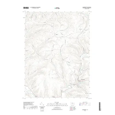
2019 Map of Coudersport
USGS Topo · Published 2019About this map
Coudersport serves as the focal point of this Potter County landscape, where the Potter County Courthouse stands as a central landmark amidst the borough's grid. The terrain is defined by a dense network of steep hollows and ridges, including Negro Hill and Dutchman Hill, which channel numerous waterways toward the Allegheny River. To the north and west, smaller settlements like Hebron and Olmsted are connected by winding valley roads that trace the paths of Fishing Creek and Dingman Run. Local history is preserved in sites such as Eulalia Cem and Saint Eulalias Cem, while the Ranch Aero Airport occupies a rare flat stretch of the river valley. The map illustrates a classic Pennsylvania mountain topography where human development is strictly dictated by the sharp rise of hills like Greenman Hill and the deep cuts of drainage basins such as Hogpen Hollow and Kavanaugh Hollow.
Find a feature on this map
77 named features on this map. Tap any name to fly to it.
Don’t see what you’re looking for? This feature index may not catch every label — zoom into the map to look around manually.
Map Details
Editions of this 2019 Coudersport Map
This is the sole edition of this map. No revisions or reprints were ever made.
Other maps of this area

1932 · Genesee
USGS Topo · 1:62,500

1934 · Coudersport
USGS Topo · 1:48,000

1937 · Genesee
USGS Topo · 1:62,500

1938 · Coudersport
USGS Topo · 1:62,500

1947 · Conrad
USGS Topo · 1:62,500

1947 · Ayers Hill
USGS Topo · 1:24,000

1948 · Emporium
USGS Topo · 1:62,500

1948 · Keating Summit
USGS Topo · 1:24,000
1948 · Austin
USGS Topo · 1:24,000
1949 · Ayers Hill
USGS Topo · 1:24,000
Featured Places
- Roulette Township, PA
- Hebron Township, PA
- Clara Township, PA
- Olmsted, Eulalia Township
- Eulalia Township, PA