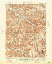
1938 Map of Coudersport
USGS Topo · Published 1948About this map
Coudersport serves as a focal point in this 1930s survey of Potter County, where the Allegheny River and Fishing Creek carve through a landscape defined by steep hollows and narrow valleys. The settlement pattern follows the drainage, with small villages like Roulette and Millport linked by the New York and Pennsylvania RR. This rail-and-river network reflects the region's historical reliance on timber and light industry during the early 20th century.
Find a feature on this map
136 named features on this map. Tap any name to fly to it.
Don’t see what you’re looking for? This feature index may not catch every label — zoom into the map to look around manually.
Map Details
Editions of this 1938 Coudersport Map
3 editions found
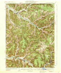
Other maps of this area

1898 · Olean
USGS Topo · 1:62,500

1925 · Belmont
USGS Topo · 1:62,500

1926 · Wellsville
USGS Topo · 1:62,500

1932 · Genesee
USGS Topo · 1:62,500

1933 · Smethport
USGS Topo · 1:62,500

1934 · Coudersport
USGS Topo · 1:48,000

1937 · Genesee
USGS Topo · 1:62,500

1937 · Smethport
USGS Topo · 1:62,500

1938 · Coudersport
USGS Topo · 1:62,500

1938 · Olean
USGS Topo · 1:62,500