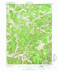
1934 Map of Coudersport
USGS Topo · Published 1966About this map
The upper Allegheny River and Oswayo Creek systems define this landscape in Potter County, where narrow valleys dictate the path of settlement and industry during the early 1930s. The regional hub of Coudersport sits at the confluence of several streams, served by the Coudersport & Port Allegany RR. The map reveals a dense network of one-room schoolhouses, such as Plank Road Sch and Greenman Hill Sch, distributed to serve the farming families living in the অসংখ্য named hollows like Wokeley Hollow and Bunker Hol. Timber and transit are evident in the path of the Buffalo and Susquehanna RR and the Fire Tower atop Crandall Hill. From the borough of Shinglehouse to the small village of Roulette, the terrain is deeply dissected, with nearly every drainage supporting a named road or small community such as Hebron Center or East Sharon.
Find a feature on this map
131 named features on this map. Tap any name to fly to it.
Don’t see what you’re looking for? This feature index may not catch every label — zoom into the map to look around manually.
Map Details
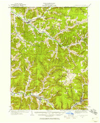
Editions of this 1934 Coudersport Map
Other maps of this area

1898 · Olean
USGS Topo · 1:62,500

1925 · Belmont
USGS Topo · 1:62,500

1926 · Wellsville
USGS Topo · 1:62,500

1932 · Genesee
USGS Topo · 1:62,500

1933 · Smethport
USGS Topo · 1:62,500

1934 · Coudersport
USGS Topo · 1:48,000

1937 · Genesee
USGS Topo · 1:62,500

1937 · Smethport
USGS Topo · 1:62,500

1938 · Coudersport
USGS Topo · 1:62,500

1938 · Olean
USGS Topo · 1:62,500