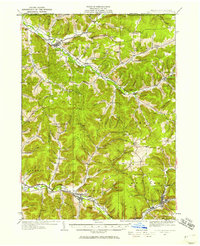
1934 Map of Coudersport
USGS Topo · Published 1958About this map
The Allegany River headwaters and the valleys of northern Potter County define this mid-1930s landscape. Industrial and agricultural connectivity is prominent through the New York and Pennsylvania RR and the Coudersport and Port Allegany RR, which snake through the valley floors to serve centers like Shingle House and Roulette. The map reveals a highly decentralized educational network, featuring numerous rural schoolhouses such as Horse Run Sch and Kenyon Sch, often located at the mouths of the region's many "hollows."
Find a feature on this map
114 named features on this map. Tap any name to fly to it.
Don’t see what you’re looking for? This feature index may not catch every label — zoom into the map to look around manually.
Map Details
Editions of this 1934 Coudersport Map
Other maps of this area

1898 · Olean
USGS Topo · 1:62,500

1925 · Belmont
USGS Topo · 1:62,500

1926 · Wellsville
USGS Topo · 1:62,500

1932 · Genesee
USGS Topo · 1:62,500

1933 · Smethport
USGS Topo · 1:62,500

1934 · Coudersport
USGS Topo · 1:48,000

1937 · Genesee
USGS Topo · 1:62,500

1937 · Smethport
USGS Topo · 1:62,500

1938 · Coudersport
USGS Topo · 1:62,500

1938 · Olean
USGS Topo · 1:62,500