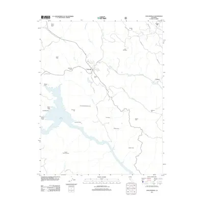
2012 Map of Coulterville
USGS Topo · Published 2012About this map
Coulterville serves as the central hub of this northern Mariposa County landscape, situated where Greeley Hill Rd and Dogtown Rd converge. The topography is defined by significant elevation changes, from the heights of Bald Mountain and Horseshoe Bend Mountain down to the sprawling waters of Lake McClure in the west. This reservoir has reshaped the local geography, inundating the lower reaches of Rancho del Oro Gulch and Picture Gallery Gulch. Historical named sites such as Dogtown and Greeley Hill remain as markers of the area's development. Numerous family-named landmarks and geographic features like Mahoney Gulch, Whites Gulch, and Louise Point reflect a long history of local land use. The network of winding roads, including Ponderosa Way and Schilling Rd, follows the difficult terrain of the Sierra Nevada foothills, connecting small settlements with the high ridges of Fugua Ridge and Hunter Valley Mountain.
Find a feature on this map
44 named features on this map. Tap any name to fly to it.
Don’t see what you’re looking for? This feature index may not catch every label — zoom into the map to look around manually.
Map Details
Editions of this 2012 Coulterville Map
This is the sole edition of this map. No revisions or reprints were ever made.
Other maps of this area

1893 · Sonora
USGS Topo · 1:125,000

1896 · Sonora
USGS Topo · 1:125,000

1897 · Sonora
USGS Topo · 1:125,000

1898 · Sonora
USGS Topo · 1:125,000

1916 · Merced Falls
USGS Topo · 1:24,000

1919 · Merced Falls
USGS Topo · 1:31,680

1944 · Merced Falls
USGS Topo · 1:62,500

1947 · San Jose
USGS Topo · 1:250,000

1947 · Coulterville
USGS Topo · 1:62,500
1947 · Jawbone Ridge
USGS Topo · 1:24,000